Weather in Kappl & See

Forecasts for planning your holiday
divider divider

Current weather forecast for Kappl & See

From sunshine to snow line

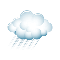
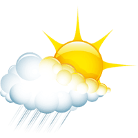
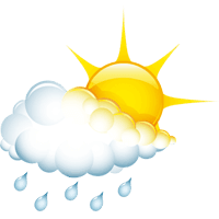
Sunglasses or rain jacket? The weather page for Kappl & See shows what conditions to expect in the valley and at higher elevations. Alongside morning and afternoon temperatures, the overview also includes hours of sunshine, the probability of precipitation, wind and the snow line. 

The weather forecast for the days ahead helps you plan ski days and winter hikes as well as summer outings. As conditions can vary depending on the elevation, Kappl and See are shown in separate weather sections. Current webcam images add a live view of conditions on the ground. 

What the weather forecast shows
  • separate weather sections for Kappl and See

  • daily forecast and outlook for the days ahead

  • temperatures and hours of sunshine for planning your day

  • probability of precipitation for the morning and afternoon

  • wind direction and wind speed at the respective altitudes

  • weather stations and current avalanche conditions

divider divider

Weather today

Temperature
4 °C / 19 °C
Sunshine hours
4 h
Weather icon
Weather morning
Temperature
4 °C
Rain probability
0 %
Wind direction
S
Wind force
7.2 km/h
Snow fall border
2800 m
weather.overview.weather-icon-20
Weather afternoon
Temperature
19 °C
Rain probability
70 %
Wind direction
SW
Wind force
10.8 km/h
Snow fall border
2900 m
weather.overview.weather-icon-2
Wednesday, 07.10.2026
Temperature
6 °C / 20 °C
Rain probability
0 %
Wind direction
SW
Wind force
23 km/h
Snow fall border
3050 m
weather.overview.weather-icon-16
Thursday, 08.10.2026
Temperature
9 °C / 16 °C
Rain probability
75 %
Wind direction
SW
Wind force
36 km/h
Snow fall border
2300 m
weather.overview.weather-icon-5
Friday, 09.10.2026
Temperature
3 °C / 11 °C
Rain probability
15 %
Wind direction
N
Wind force
25 km/h
Snow fall border
1700 m
weather.overview.weather-icon-14
Saturday, 10.10.2026
Temperature
5 °C / 13 °C
Rain probability
30 %
Wind direction
W
Wind force
38 km/h
Snow fall border
2350 m
weather.overview.weather-icon-13
Sunday, 11.10.2026
Temperature
5 °C / 11 °C
Rain probability
25 %
Wind direction
W
Wind force
47 km/h
Snow fall border
1950 m
weather.overview.weather-icon-2
Monday, 12.10.2026
Temperature
3 °C / 14 °C
weather.overview.weather-icon-2
Tuesday, 13.10.2026
Temperature
3 °C / 16 °C

Weather forecast for Kappl

The forecast in detail
The upper-level low-pressure system over our region, which will bring us another spell of rain showers on Tuesday afternoon, will finally move away by Wednesday. With a strengthening south-westerly Föhn wind, the day will bring pleasant, sunny and comfortably warm conditions. On Thursday morning, the southerly Föhn will weaken in the mountains, allowing the last patches of cloud to clear. In the afternoon, a cold front will sweep in, bringing heavy rain and a significant drop in temperature lasting until Friday morning. On Friday itself, dry and sunny conditions will quickly return. However, the improvement in the weather will be only temporary, as on Saturday new, extensive cloud fields will move in front of the sun. Some precipitation is then expected, particularly during the night leading into Sunday, towards the northern edge of the Alps. On Sunday, the weather will improve once again, and this improvement is set to continue into next week.

Current weather conditions

Live from Kappl
scroll
Name Altitude Temperature Wind force Webcam
Diasbahn Bergstation
Open webcam
1.830 m 12 °C 4 km/h
Alblittkopf
2.700 m 5 °C 16 km/h
1.180 m 0 °C -

Weather today

Temperature
8 °C / 20 °C
Sunshine hours
4 h
Weather icon
Weather morning
Temperature
8 °C
Rain probability
0 %
Wind direction
S
Wind force
7.2 km/h
Snow fall border
2800 m
weather.overview.weather-icon-20
Weather afternoon
Temperature
20 °C
Rain probability
70 %
Wind direction
SW
Wind force
10.8 km/h
Snow fall border
2900 m
weather.overview.weather-icon-2
Wednesday, 07.10.2026
Temperature
7 °C / 21 °C
Rain probability
0 %
Wind direction
SW
Wind force
23 km/h
Snow fall border
3050 m
weather.overview.weather-icon-16
Thursday, 08.10.2026
Temperature
10 °C / 17 °C
Rain probability
75 %
Wind direction
SW
Wind force
36 km/h
Snow fall border
2300 m
weather.overview.weather-icon-5
Friday, 09.10.2026
Temperature
4 °C / 12 °C
Rain probability
15 %
Wind direction
N
Wind force
25 km/h
Snow fall border
1700 m
weather.overview.weather-icon-14
Saturday, 10.10.2026
Temperature
6 °C / 14 °C
Rain probability
30 %
Wind direction
W
Wind force
38 km/h
Snow fall border
2350 m
weather.overview.weather-icon-13
Sunday, 11.10.2026
Temperature
6 °C / 12 °C
Rain probability
25 %
Wind direction
W
Wind force
47 km/h
Snow fall border
1950 m
weather.overview.weather-icon-2
Monday, 12.10.2026
Temperature
4 °C / 15 °C
weather.overview.weather-icon-2
Tuesday, 13.10.2026
Temperature
4 °C / 17 °C

Weather forecast for See

The forecast in detail
The upper-level low-pressure system over our region, which will bring us another spell of rain showers on Tuesday afternoon, will finally move away by Wednesday. With a strengthening south-westerly Föhn wind, the day will bring pleasant, sunny and comfortably warm conditions. On Thursday morning, the southerly Föhn will weaken in the mountains, allowing the last patches of cloud to clear. In the afternoon, a cold front will sweep in, bringing heavy rain and a significant drop in temperature lasting until Friday morning. On Friday itself, dry and sunny conditions will quickly return. However, the improvement in the weather will be only temporary, as on Saturday new, extensive cloud fields will move in front of the sun. Some precipitation is then expected, particularly during the night leading into Sunday, towards the northern edge of the Alps. On Sunday, the weather will improve once again, and this improvement is set to continue into next week.

Current weather conditions

Live from See
scroll
Name Altitude Temperature Wind force Wind direction Webcam
Ascher Hütte
2.250 m °C km/h
Istalanz
0 m °C km/h
Medrigalm
Open webcam
1.800 m °C km/h
1.100 m °C km/h
2.250 m °C km/h
divider divider

More live information from Kappl & See

Webcams, snow report and slope status
divider divider

Frequently asked questions about the weather in Kappl & See

The weather forecasts for Kappl & See show the outlook for today and the days ahead. They include temperatures, hours of sunshine, probability of precipitation as well as wind direction and strength.

Exact snow depths and information on slope conditions are available in the snow report. The webcams provide a visual impression of current conditions.

The current avalanche warning level for Kappl & See is shown in the snow report. Always check this information before heading into unsecured terrain.

The multi-day weather forecast for Kappl & See shows how conditions are expected to develop over the next days. The further ahead the forecast looks, the more likely it is to change. Before a planned activity, it is therefore worth checking the latest forecast and webcams again.